Thursday, October 13, 2011

Uphill trek continues toward Llactapata pass and Machu Picchu


Wild orchids abound! What a beautiful land!


Distant view of Machu Picchu!


We have an early morning grueling uphill trek for about 3 hours en route to Llactapata pass (elevation 8,900 ft) where the climb culminates in a rare and distant view of Machu Pichchu from the southwest (a view not often seen by tourists). We find a thatch covered shelter where we have a lunch of river trout and passion fruit!

A lovely (wild) white horse is ahead of us, quietly and persistently leading us down our path. She seems like the elusive unicorn and I've nicknamed her UNI!


Our room at Aguas Calientes (the village and market town that is closest to Machu Picchu! The rooms were absolutely lovely and I must say that Gene and I enjoyed dickering with the local market vendors as we bargained for trinkets to bring back to the "kids."

Wednesday, October 12, 2011

Over the river and through the cloud forest to the coffee plantation


We departed early today and headed down through the Santa Teresa River Valley continuing to undulate through the verdant cloud forest. We followed the ridges high above the river valley of the St. Theresa through more populated rural areas. We passed through banana, granadilla, and avocado orchards as well as coffee plantations (said to be some of the best organic coffees in the world).


It was necessary to traverse the river several times...sometimes walking through the water, sometimes hiking over the suspension bridges!


Nestled in a garden adjacent to the coffee plantation, this was my favorite lodge. I drank manzanilla tea as the rest of the gang took a walking tour!

Tuesday, October 11, 2011

Hike downhill through the cloud forest


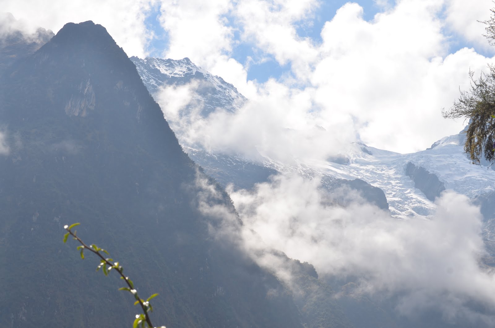
This is a breath-taking (no pun intended) early morning vista from our trail at 11,000 ft.


My trusty horse (which thankfully I didn't need once we got over the mountain pass.)


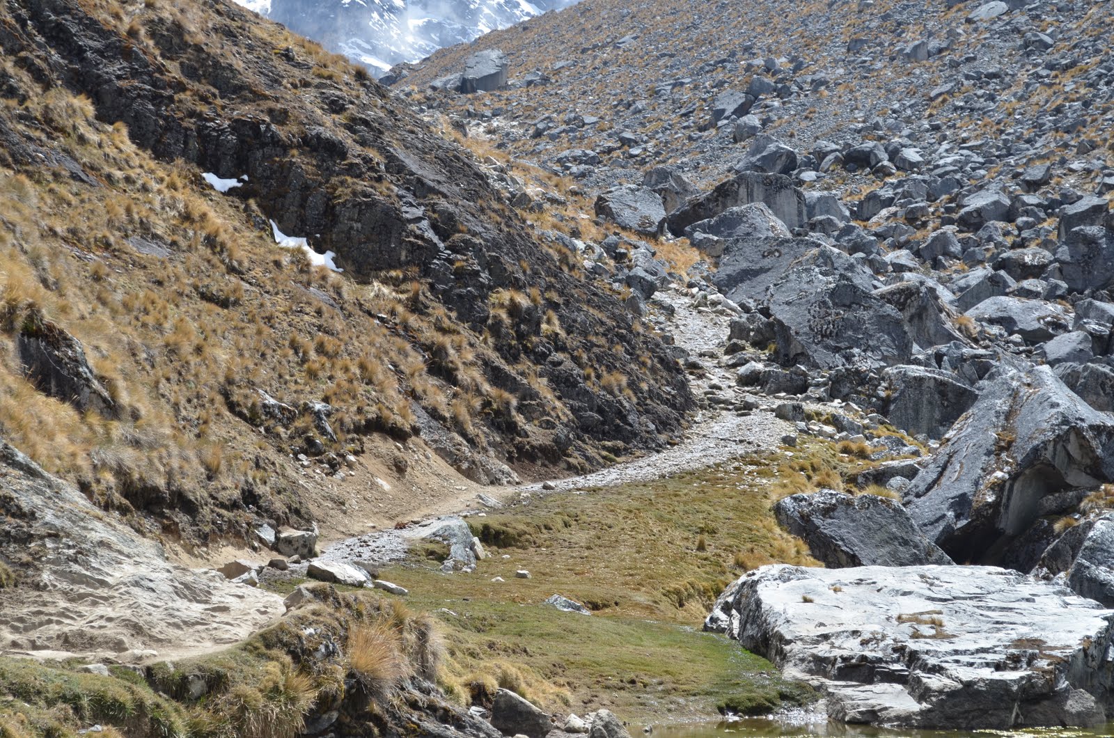
After the strenuous, lung-bursting uphill hike yesterday, we began a long downhill picking our way over steep terrain and treacherously loose rocks. The hike started out in the brisk morning air with blue skies and vistas of clouds like moats around the steeple mountain peaks.


We continued down for 3000 ft. in altitude passing through a cloud forest.


Our trail follwed the Salkantay River far below us in the valley. It was mesmerizing to hear the white water song.


In the cloud forest we saw many blooming orchids in vivid reds, yellows, and blues. We could hear the parrots and at one point saw a group of neon green parakeets flying in a large flock below. As we descended through the cloud forest, the vegetation grew more colorful and lush. Most of these flowers are parasites subsisting off of the trees.


In the middle of the day we stopped at a covered shelter where we were swarmed by dozens of hens and roosters (obviously wanting some variation to their usual diet).


In the evening we enjoyed a Peruvian barbecue featuring the national delicacy.....GUINEA PIG. Even though they assured me that this tastes just like chicken, I opted for the pork instead.

In the evening, David's talk was about the Incas. They built on top of canyons and their most important city was Machu Picchu. The Incas united the conquered tribes by enforcing a common language (Ketchua). They were 18,000 strong and were a very healthy and fit people (which they would need to be to live in this rugged terrain.)

Monday, October 10, 2011

Saraypampa to Wayra Lodge at Huayraccmachay over the mountain pass

The big day we've all been anticipating with trepidation because we are going to hike up over the Salkantay Pass at 15,000 ft. elevation. After an early start, we will hike up the Rio Blanco valley, circling the two towering peaks of Humantay and Salkantay


.

At the pass, we will stop to take in the panoramic views of the snow capped peaks of the Vilcabamba Range. I, again, mount the horse because I'm having difficulty breathing....and movement feels as though I'm in slow motion.


The trail keeps climbing.


The sign that is proof we climbed to 15,253 ft. altitude!!!!!


Wayra Lodge (Wayra means Wind). Tonight we star gaze as David' explains the different constellations that can be seen in the southern hemisphere. There is no light pollution from civilization because we are so isolated. The stars are a dense show of crystals in the night sky!

Salkantay Lodge and the 4 hour hike up to the glacier lake


The hike to the lake (starting at 12, 500 ft altitude) was exhilarating and more than I could handle with my altitude sickness. For most of the climb, I rode a lovely little white horse who was amazingly sure-footed (for a horse). Once I turned my fate over to equine savior and learned to not look into the sheer drop-offs, I began to enjoy myself immensely. In fact, I reached the summit ahead of everyone else making me feel as though I were the only human on top of this mystical world above the clouds. Loved it!


The gorgeous turquoise glacial lake which, by the way, several of the most daring among our little tribe, dove in and swam VERY briefly. Gene got his ankles wet!!!


A mating pair of Condor flying above the trail!


A rest stop dwelling (local farm hut). This evening after David's lecture, we had a demonstration of the proper way to make a Pisco. Gene was the volunteer guinea pig. He didn't know how to separate the yolk from the egg white! Wow!

Cusco to Salkantay Lodge 12,500 ft. elevation


We were picked up from our lodgings at 7:00 am and met our first fellow travelers on the trek adventure, two very witty Australians who hailed from the province of Taizmainia!


En route we saw some Inca ruins at Limatambo and then took a short break at the mountain village of Mollepata where we drank cocoa tea and saw the guinea pigs in the nearby pen being fattened up for someone's dinner!


Then we ascended a very steep and winding mountain road to Marcocasa where the trek to Soraypampa began. The trail was an ancient route called "Camino Real" or Royal Path.


David' (pronounced with the emphasis on the second syllable) was our guide. He is a descendant of the Inca people and very knowledgeable. Sidebar: 60% of Peru is rain forest. 80% of the population lives along the coast. Peru has 80% of the micro climates of the world; 1800 bird species; and 3,000 rivers that start in the mesa and flow through the rain forests to converge in the mighty Amazon River (largest in the world).


Getting the first glimpse of our isolated mountain lodge in the shadows of the Andes was a welcome sight. This is the view of the glacier from our lodge window!